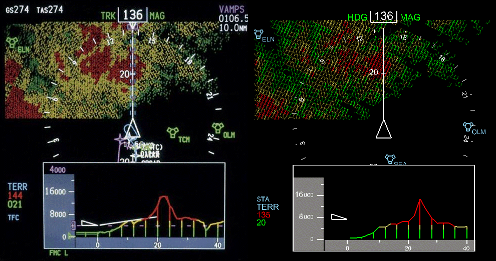
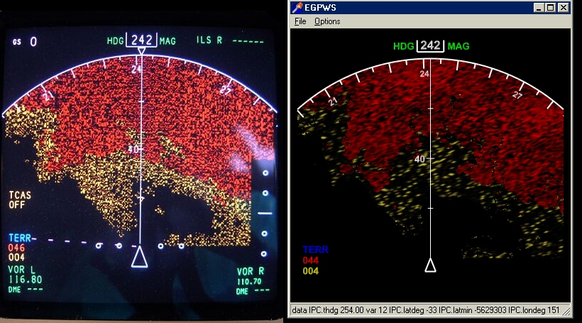
The Vertical Situation Display (VSD) was recently introduced by Boeing. This
image shows a flight directly into the side of Mt. Rainier. Please
compare to the original image shown in the
Aero Magazin Vol. 20.
The left side of the comparison shows the original Boeing VSD, while the graphic on the
right hand side shows a simulation using the 'External PS1.3 Flight Instruments'.
|
|
| 
|
|
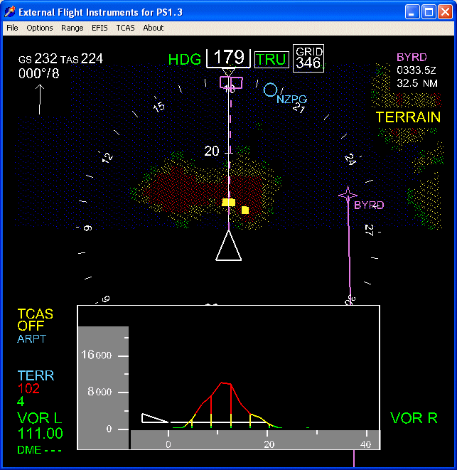
Left: The ANZ Crash at Mt. Erebus might have been avoided with EGPWS installed and the
terrain profile displayed on a VSD. The image shows that a terrain caution alert
is generated when approach Ross Island, Antarcitca.
|
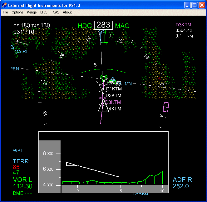
Right: Situational awareness approach Kathmandu airport with EGPWS and VSD activated. (Note:
the VSD is not yet available on 747-400 aircraft.)
|
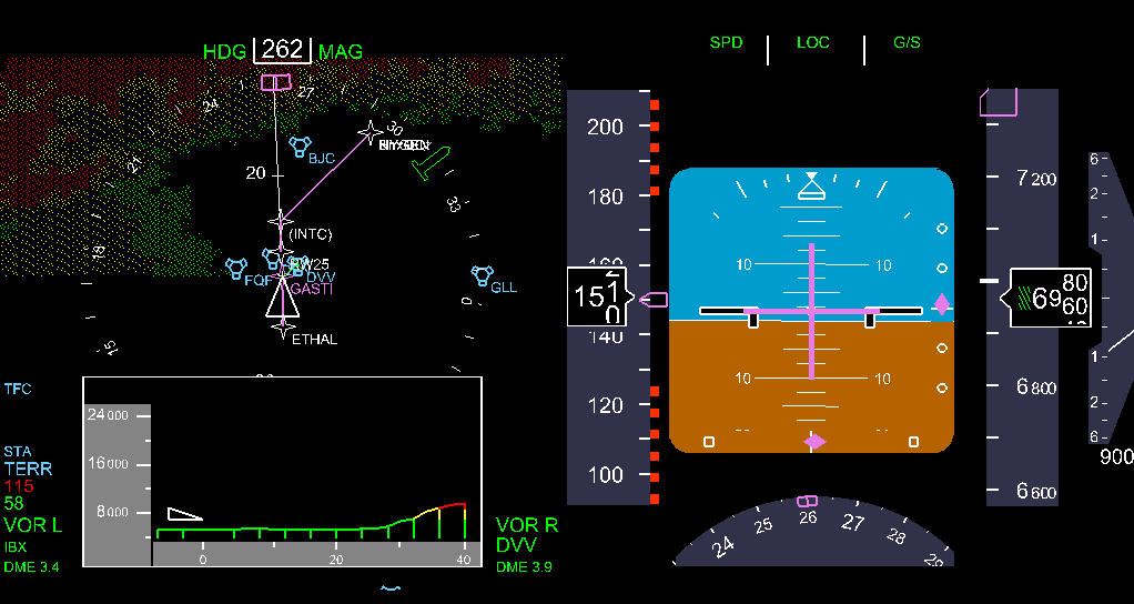
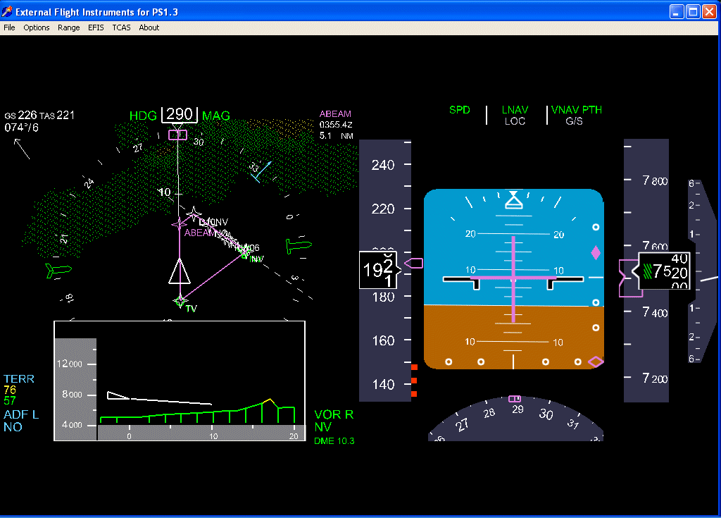
Approach Denver on the ILS25 approach. The PFD is switched on and set to the F/O configuration. The Vertical
Situation Display nicely shows the Rocky Mountains 30 nautical miles away.
|
|
| 
|
|
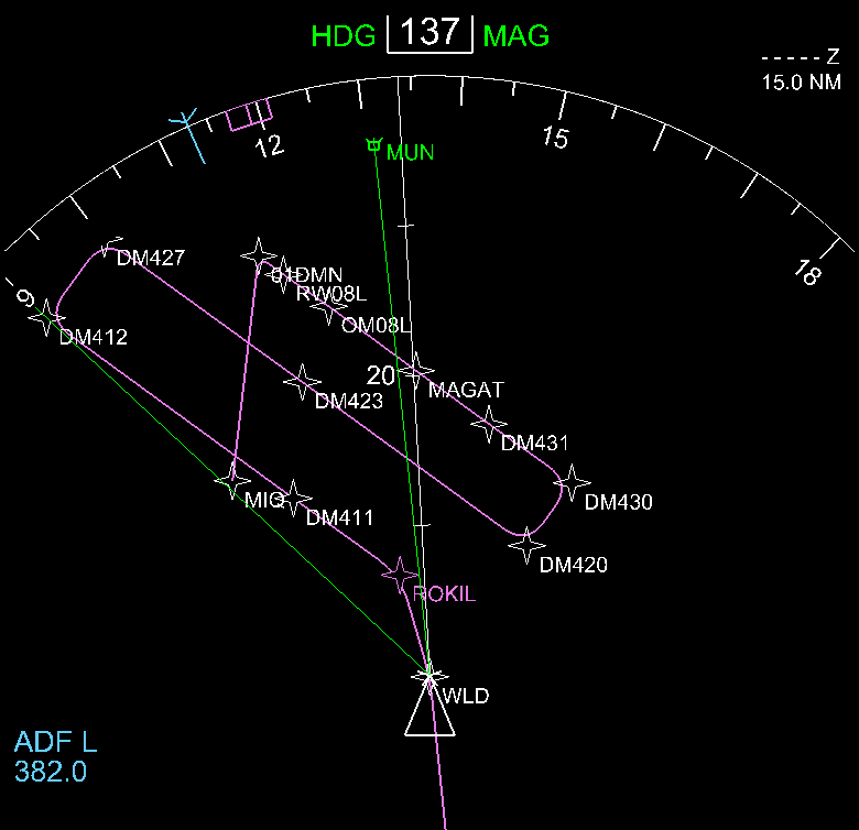
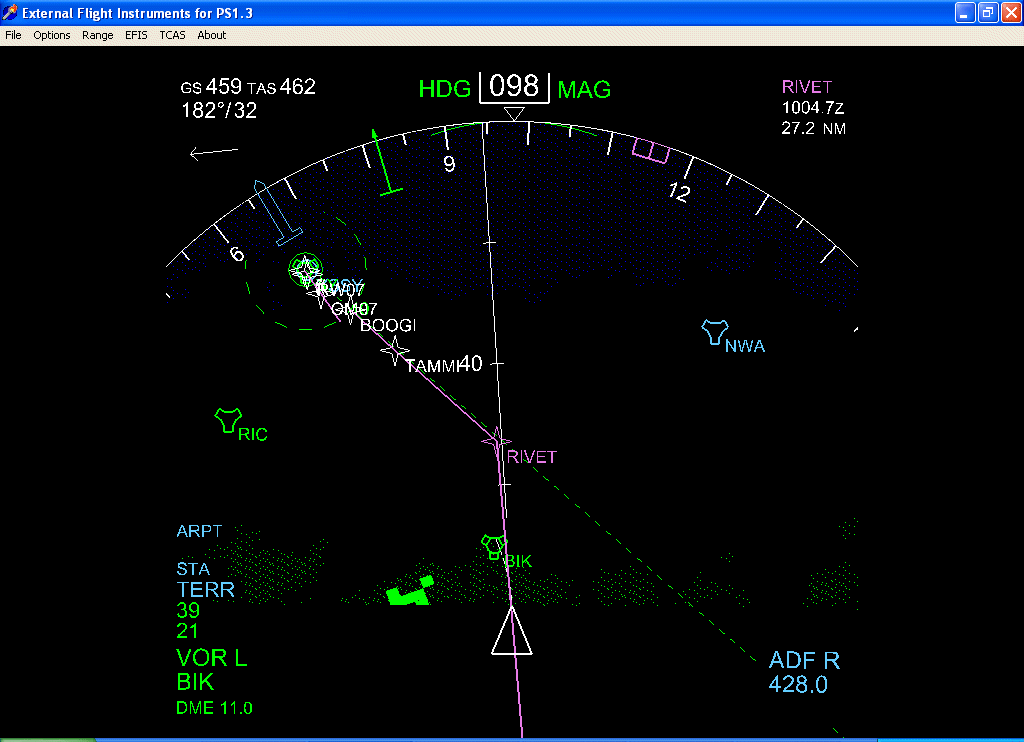
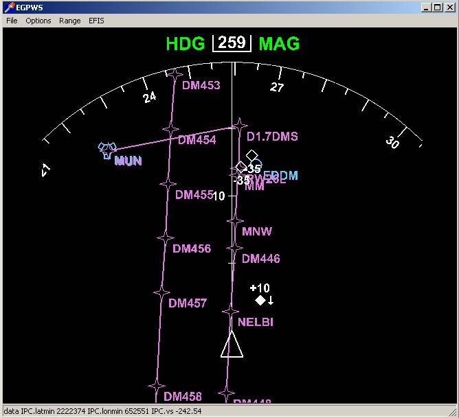
Left: LNAV/FMC route display. Approach Munich from the North-West with ROKIL26 approach
transition selected. The LNAV route is read from the PS1.3 memory in real time and
always in sync with PS1.3. Note that the 'smooth' curves at fly-by waypoints are
not yet available in the release version. The green lines show the VOR raw data.
|
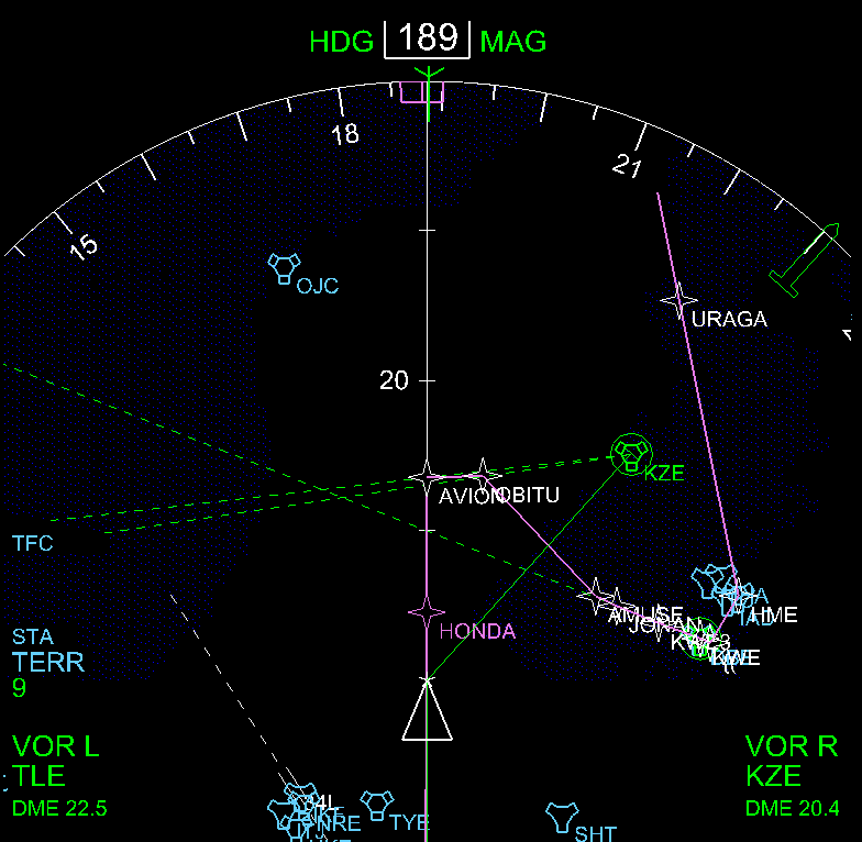
Right: Approaching Tokyo-Haneda. Sea Level display (blue colour) is switched on. (Although
blue sea level colour is available on EGPWS systems, it's not yet available on the
747-400.) For awareness,
several VOR radials have been programmed into the FMC FIX INFO page of PS1.3. They are
also visible on the external OpenGL navigation display.
|
| 
|
|
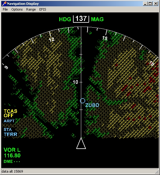
Left: The External Flight Instruments for PS1.3 support all FMC position features including
IRS position 1, 2 and 3 and FMC position. Thus, map shift is shown not only in PS1.3 but
also correctly reproduced on the OpenGL display. This ND screenshot shows a situation where
the raw data VOR position (T-symbol) disagrees with the FMC VOR position.
|
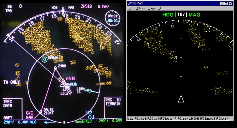
Right: Approach Instanbul airport during a VATSIM fly-in. Three aircraft can be seen ahead on
approach to runway 06. All aircraft data is taking from Squawkbox SB747 and EGPWS is
switched on to show the highest elevations on display in 'Peaks Mode' using green colour.
|

| 
|
|
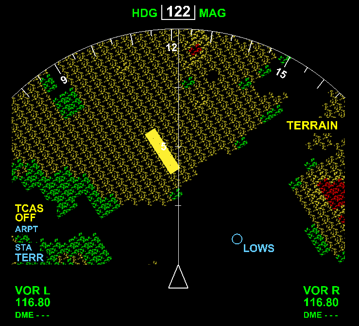
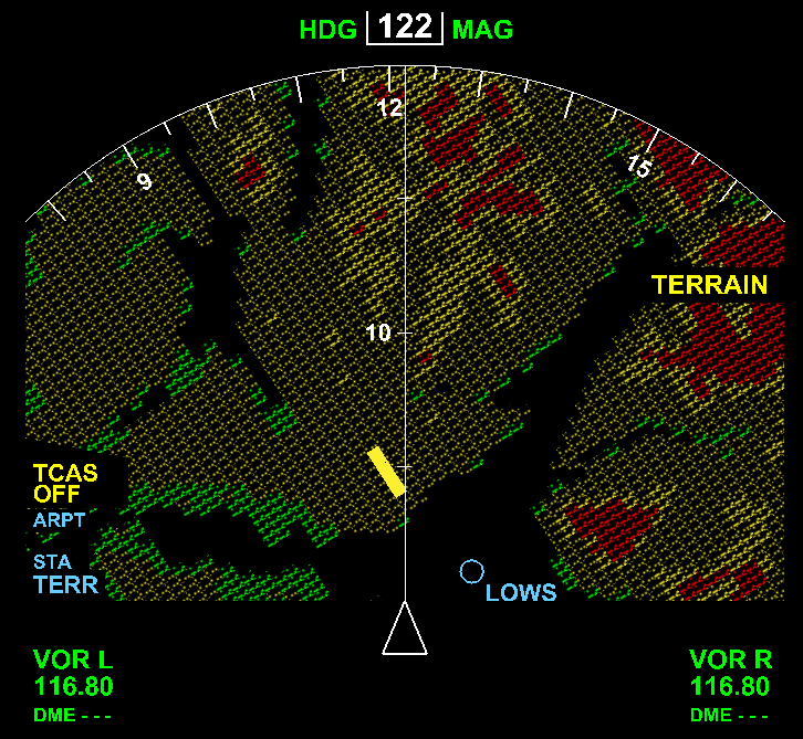
Left: Flying over Iran southbound towards to Persian Gulf. The 'Peaks Mode' display of EGPWS
shows the mountain peaks in green, with elevations up to 14.300'. Kuwait and Iraqui cities
are visible to the right of the flight track. Please, compare the image to an actual photo taken at almost the same
position!.
|
Right: Again, 'Peaks Mode' and sea level display while approach Sydney. We are already descending
and the VOR and NDB needles are alive. The wind speed and direction as well as the FMC route
(incl. arrival times, in the top right corner) are obtained from PS1.3 in real time.
|
|
|
|
|
EGPWS predicts a possible terrain thread and starts a Terrain Caution Alert. Actually, this is
the terrain look-up function, which looks even for further distant terrain threads than the
EGPWS look-ahead feature.
Taken while flying a Visual Circling Approach at Salzburg, Austria. |
(left) Peaks Mode enhanced EGPWS Terrain Elevation Data display of a B747-400
of Malaysian Airlines. Aircraft is parked at Sydney Kingsford Smith Int'l (YSSY) (right)ND project showing simulated Terrain Data from the same parking position. |
External PFD with localizer and glideslope needles. FMA and F/D are switched off.
|
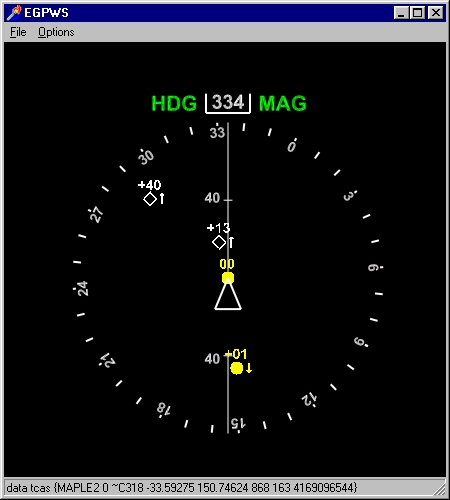
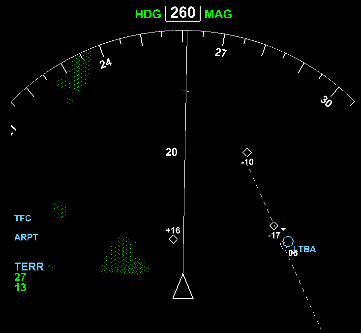
Actual online traffic (connected to VATSIM using SB747).
All features (TA, RA detection, climb/descent arrows) are fully functional.
|
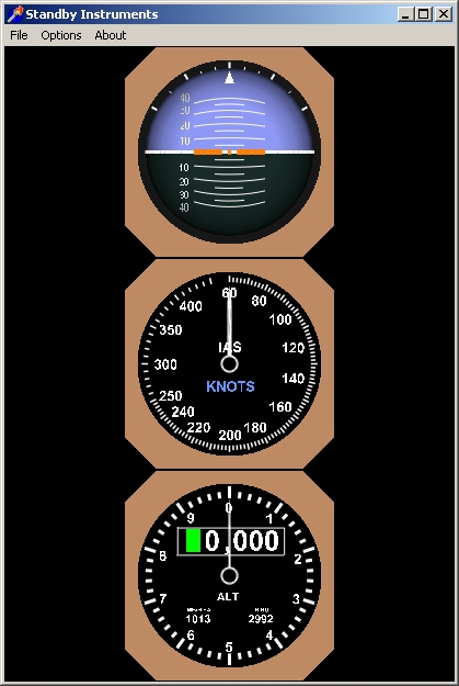
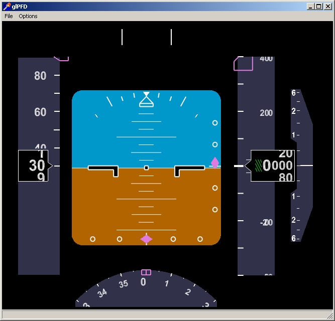
Standby Instruments for PS1.3. Any number (1-3) of instruments can be displayed.
All instruments are resizeable and fully functional when connected to PS1.3.
|
Early work on display of the FMC route in the external ND. The route shows an RNAV transition
to the EDDM (Munich) ILS26L approach. Note the VATSIM TCAS targets on the ground and on parallel
approach to 26R!
|
(left) EGPWS terrain data as seen on a MD-11 aircraft departing LSZH (Zurich).
(right) Simulation of the terrain elevation on the B747-400 ND. MD-11 photo (c) Markus Burkhard, airliners.ch. |
|

Watch an AVI-Movie - showing EGPWS terrain (LOWI/Innsbruck) and TCAS traffic.
Another Movie is also available!
|
Terrain Elevation Display on ND during approach into Bangda/Tibet, China. Bangda is the
highest elevation airport in the world open to large commercial aircraft.
|